NASA, SWOT satellite capture unprecedented view of giant Pacific Tsunami that affected Russia, Japan; Hawaii; reveal complex wave patterns
The Surface Water Ocean Topography (SWOT) satellite captured a detailed look at the tsunami, showing a complex pattern of waves dispersing and scattering across the ocean. The image shows a more intricate process, with waves breaking up and dispersing in multiple directions.
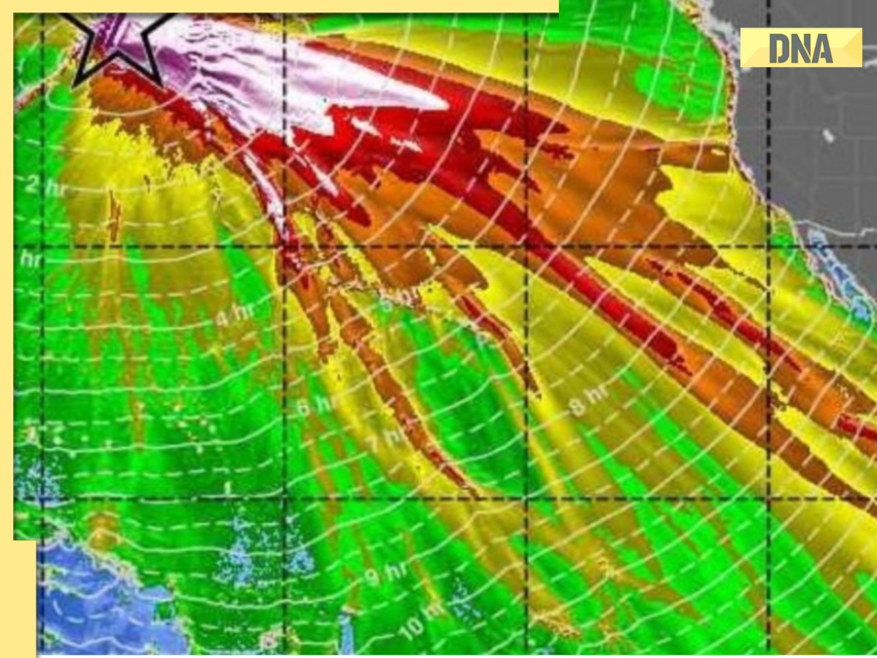
NASA and the French space agency's SWOT satellite have captured a rare event, a Pacific-wide Tsunami triggered by an 8.8 magnitude earthquake that struck the Kuril-Kamchatka subduction zone on July 29, 2025. They captured the event, revealing a complex, braided pattern of energy dispersing across hundreds of miles. This challenges traditional assumptions about tsunami behaviour, which is likely a single neat crest racing across the basins. The new experiment suggests current physics models need revision, especially regarding 'non-dispersive' wave packets.
Detailed look at Giant Tsunami
The Surface Water Ocean Topography (SWOT) satellite captured a detailed look at the tsunami, showing a complex pattern of waves dispersing and scattering across the ocean. The image shows a more intricate process, with waves breaking up and dispersing in multiple directions. The SWOT satellite's advanced technology enabled scientists to map a 75-mile-wide swath of sea surface height in a single pass. According to study lead author Angel Ruiz-Angulo, "SWOT data is like a new pair of glasses, allowing us to see the tsunami in unprecedented detail".